Pioneer Basin Backpacking

John Muir Wilderness

Pioneer Basin, John Muir Wilderness, California

Pioneer Basin Backpacking

John Muir Wilderness


Backpacking to Pioneer Basin

Deep in the John Muir Wilderness

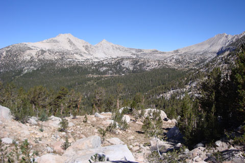
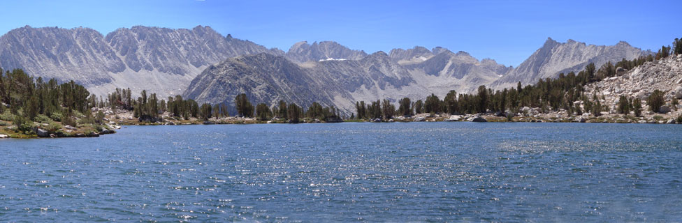
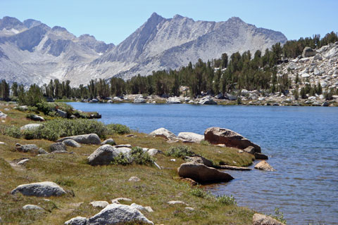
The seven lakes in Pioneer Basin are spread across an alpine valley on the Mono Creek drainage, west of Rock Creek. Surrounding the valley are peaks named after the Big Four, pioneer California businessmen who backed the construction of the first transcontinental railroad - Stanford, Hopkins, Crocker, and Huntington. Gentle terrain across the basin allows hikers to wander easily from lake to lake while enjoying vistas of grand scenery.

Although it is possible to reach Pioneer Basin from the west, coming up from Lake Edison, most backpackers prefer the shorter approach over 12,000-foot Mono Pass from Rock Creek on the eastern side of the Sierra. The 8-mile route includes climbing about 2,000 feet and descending a similar elevation.

Pioneer Basin, John Muir Wilderness, California

Pioneer Basin

Pioneer Basin - Key Facts


Location: John Muir Wilderness, west of Rock Creek.
Trailhead: Mosquito Flat, along Rock Creek, elevation 10,240'
Highest point on Trail: Mono Pass, 12,068 feet
Elevation of lowest lake in Pioneer Basin: 10,383 feet
Elevation Gain: 2,150 feet (total)
Elevation Loss: 2,006 feet
Hiking Distance: 8 miles
Best seasons: Mid-summer to fall
Campsites: Good sites at lower lakes


sign to Pioneer Basin, 8 miles

Wildlife

Although Bears are unlikely as high as Pioneer Basin, on rare occasions they have been known to roam up to 14,000 feet. Bear canisters are not required, but the trees around the upper lakes are not tall enough for effective hanging of food. Deer frequent the Mono Creek area, but usually only venture into Pioneer Basin in the fall. Rattlesnakes are unlikely along the trail, but hikers should always use caution. Off-trail travelers should keep their eyes open.

Mosquitoes are especially annoying from early summer through mid-August. By late August and through September they are usually not a problem. Look for marmots peeking out on the rocks around Pioneer Basin.


Pioneer Basin viewed from Mono Pass, John Muir Wilderness, California

Pioneer Basin in the Distance, Viewed from Mono Pass


Trekking Poles


Pioneer Basin - Key Facts


Location: John Muir Wilderness, west of Rock Creek.
Trailhead: Mosquito Flat, along Rock Creek, elevation 10,240'
Highest point on Trail: Mono Pass, 12,068 feet
Elevation of lowest lake in Pioneer Basin: 10,383 feet
Elevation Gain: 2,150 feet (total)
Elevation Loss: 2,006 feet
Hiking Distance: 8 miles
Best seasons: Mid-summer to fall
Campsites: Good sites at lower lakes


sign to Pioneer Basin, 8 miles

Mosquito Flat
Pioneer Basin Trailhead

The trailhead for Mono Pass and Pioneer Basin is at Mosquito Flat on Rock Creek Road, 11 miles west of Highway 395 and Tom's Place. The same trailhead serves Little Lakes Valley. Follow Rock Creek Road to its end at Mosquito Flat. A large parking lot is located there with vault toilets and a kiosk with maps of the area and other information. Little Lakes Valley is a popular day hiking area so the parking lot can be crowded during the summer


Nearby Lodging and Camping

Rock Creek Lakes Resort features rental cabins, boat rentals, a store, and a cafe.

Rock Creek Lodge has rental cabins and a breakfast cafe.

Rock Creek Area Camping

Many National Forest campgrounds are located along the road leading into the trailhead. At the trailhead is Mosquito Flat Backpacker Campground, a free, one-night camping spot for backpackers heading out on the trail the next day. Sites are walk-in.

You can find out complete details about the best campsites along Rock Creek at California's Best Camping - Inyo County.

logo saying California's Best Camping