Golden Bear Lake Trail and Map

Kings Canyon National Park

photo of Golden Bear Lake, Kings Canyon National Park, California

Golden Bear Lake Trail and Map

Kings Canyon National Park


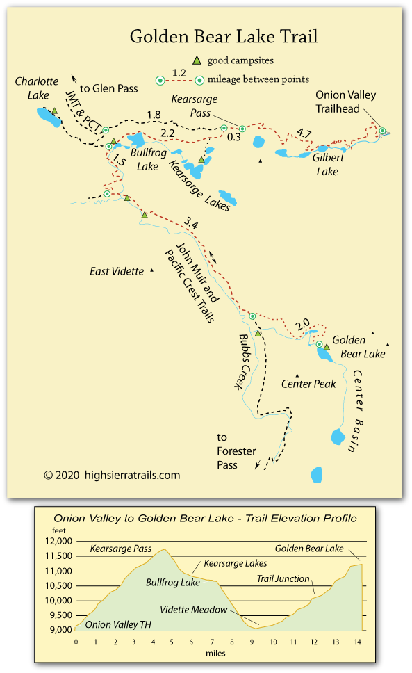
Hiking to Golden Bear Lake

One of the great attractions of the hike to Golden Bear Lake is the magnificent scenery along nearly every mile of trail. For most backpackers the trip to Golden Bear Lake is spread over two days. With 11,700-foot Kearsarge Pass in the first day of hiking, the climb from Vidette Meadow (9,190') up to Golden Bear Lake (11,200') is best left for the second day.

Onion Valley to JMT Junction,

7.2 miles

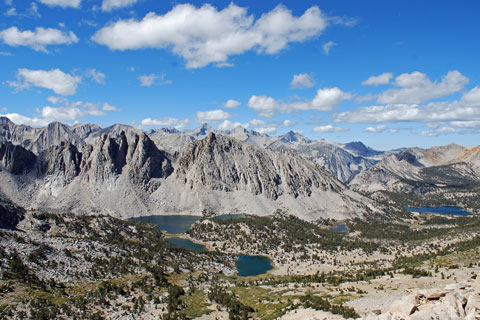
The trail from the Onion Valley parking lot begins climbing immediately, soon passing a series of scenic mountain lakes, including Gilbert Lake and Flower Lake. Hikers emerge above timberline for the last mile to the top of Kearsarge Pass (4.6 miles).

Shop Amazon for: Hiking Poles


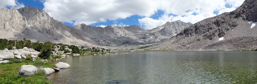
Kearsarge Lakes offer a convenient overnight camping destination; however, bear boxes are no longer available there (2017). While camping is not allowed at Bullfrog Lake, continuing past the lake to the JMT junction leads to good sites, 2.6 miles from the top of the pass.

Kearsarge Lakes, Kings Canyon National Park, California

Kearsarge Lakes with Bullfrog Lake in the Distance


JMT Junction to Golden Bear Lake,

6.9 miles

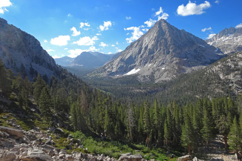
Head downhill toward Vidette Meadow, enjoying wonderful views of the area as you descend. At the bottom of the hill turn south and follow the John Muir Trail up the Bubbs Creek Valley. Along the way enjoy a number of small waterfalls.

Keep a sharp eye out for the unmarked turnoff to Center Basin and Golden Bear Lake. If you reach Center Basin Creek, you have gone ⅓ mile too far. The first mile up to Golden Bear Lake is steep. Then the trail levels out and winds around meadows - often marshy - to the lake.

East Vidette Peak, Kings Canyon National Park, California

East Vidette Peak Overlooking Vidette Meadow


Alternate Itineraries


Half Day Head Start

One way to lessen the impact of the 2,500-foot climb up Kearsarge Pass on the first day is to stop at one of the beautiful lakes part way up the eastern side of the pass. Among them are Gilbert and Flower lakes.

Alternative Midway Campsites

Instead of camping at the John Muir Trail junction, consider a 1-mile side-trip out to Charlotte Lake. The pretty lake offers some fairly nice campsites and good fishing. A ranger station is located there.

If hikers are feeling energetic coming off the pass, then continue on down the trail into Vidette Meadow. Great campsites are found at the lower end of the meadow and in several places upstream for a mile.

Backpacking Stoves

Undoubtedly the most popular backpacking stoves today are the Jetboil line of stoves. Light weight, durability, compactness, reliability, speed and fuel efficiency are among the attributes most commonly cited. For its purpose of boiling water, it is hard to beat. The Jetboil stoves come in a variety of styles with a range of prices. Carry matches or a lighter as a backup to its ignition system.


For those seeking lighter weight, the MSR PocketRocket Stove is popular. It works well. Efficiency can be improved by a loosely fitted aluminum foil wind screen. The PocketRocket is best for small pots. Use caution around it to avoid knocking it over.


map of trail to Golden Bear Lake, Kings Canyon National Park, CA