High Sierra Trail - Route Description and Maps, II
High Sierra Trail Route Description and Maps, II
Hiking the High Sierra Trail, Part II
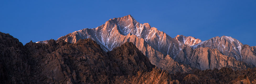
The final days on the High Sierra Trail take hikers to the summit of Mount Whitney and back down to civilization at Whitney Portal. After so many days on the trail, much of it at high elevations, the final push to the top of Mount Whitney is easily taken in stride.
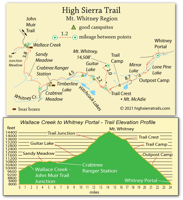
Leaving Junction Meadow, hikers follow the trail up the Wallace Creek canyon to join the John Muir Trail/Pacific Crest Trail at Wallace Creek Junction. Good campsites are found on either side of Wallace Creek and bear boxes are available. Expect to see an increase in hikers on the popular trail, but not so many as to make it feel crowded.
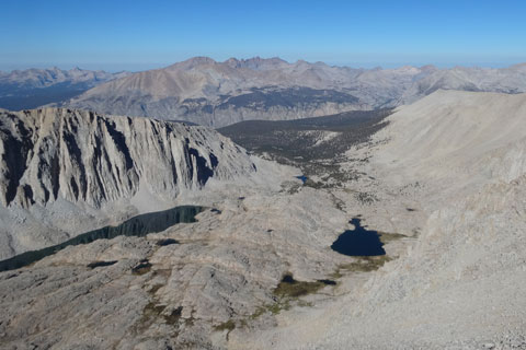
Guitar Lake from Mount Whitney Trail
After Wallace Creek the trail climbs slightly and then continues over gentle terrain through Sandy Meadow and down to Crabtree Meadow. The ranger station is located a short distance off the trail, so most hikers pass without seeing it. However, good campsites are available there along with bear boxes.
Beyond Crabtree Meadow the trail begins to climb toward Mount Whitney. Pass pretty Timberline Lake (no camping) and on to Guitar Lake. While most people choose the lake as their final camping spot before setting out for Mount Whitney, small campsites and water can be found 0.5 to 0.9 miles beyond the lake. The higher camps knock off 500-600 feet of elevation from the push to the summit the next day.
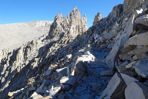
Trail up Mount Whitney
Guitar Lake to Whitney Portal
15.6 miles
Most hikers camped at Guitar Lake make an early start for Mount Whitney, using headlamps to find their way. The trail climbs steadily with switchbacks up to a trail junction just below Trail Crest. From there one trail heads up Whitney and the other on up to Trail Crest and down to Whitney Portal. Most hikers leave their packs at the junction, carrying only essentials such as snacks, water, warm clothing, possibly rain gear, and a camera for the final push.
From the trail junction, it is about 2 miles and 1,560 feet to the summit. Most of the trail is easy to navigate, but some spots call for a little boulder scrambling. The elevation will be evident as your steps slow near the top.
Trail up Mount Whitney
After enjoying the views from the top, retrace your steps to the junction where packs were left. Then make a short climb to Trail Crest and begin the long descent to Whitney Portal - 8.7 miles and 5,100 feet in elevation (6,200 feet from the summit of Mount Whitney). The first section is switchbacks down a talus slope. Then the trail passes Trail Camp followed by Outpost Camp before more switchbacks down to Whitney Portal. Tired hikers have become disoriented and lost on this section of trail, so stick together with your party and be sure you are on the main trail.
Hikers within the Whitney Zone must carry and use wag bags for disposal of human waste. Backpackers are not permitted to dig the familiar cat hole, 6"+, for disposal of human waste. Both poop and toilet paper must be "deposited" in the wag bag and packed out for disposal at the trailhead. The kits are provided by rangers at check-in or at a station along the trail near Crabtree Meadow.
Camping at Crabtree Meadow
A ranger station, pit toilet, and large camping area make a convenient camping place for those headed along the John Muir or High Sierra trails. Bear boxes are available. Campfires are not permitted.
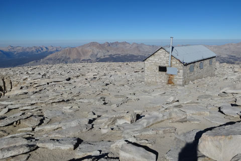
The Smithsonian Mt. Whitney Hut
The stone hut on the summit of Mount Whitney was erected by Smithsonian astronomers in 1909. At the time, "the tiny astronomical outpost represented the pinnacle of scientific endeavors. The hope was that from observations made here, high enough to escape much of Earth's atmosphere, the researchers would be able to detect the existence of water, if not life, on Mars."
The actual construction of the hut was done by a crew under the direction of Lone Pine resident Gustave Marsh. Donkeys carried the necessary supplies used to build the 11 x 30-foot, 3-room structure. A telescope was installed. "Our instruments consisted of a sixteen-inch horizontal reflecting telescope and a suitable spectroscope connected with it. It was necessary to protect all parts from the wind, and a canvas shelter was constructed to enclose the instruments." In 1977 the hut was placed on the National Register of Historic Places.
Today it serves as a shelter for weary hikers.
Mount Whitney History
The 1864 California Geological Survey team recognized the peak as the highest summit in the Sierra and named it after their leader, Josiah Whitney. The recognized first ascent of Mount Whitney was made by three local fishermen, Charley Begole, Johnny Lucas, and Al Johnson. They arrived on the summit at noon on August 18, 1873.
John Muir reached the summit only a couple of months later, taking a route from the eastern side, today known as the Mountaineers' Route. A pack trail from the east side was completed in 1904 by Gustave Marsh.