John Muir Trail Map 2

Tuolumne Meadows to Reds Meadow

John Muir Trail, Yosemite National Park, California

John Muir Trail Map 2

Tuolumne Meadows to Reds Meadow


John Muir Trail Map 2

Tuolumne Meadows to Donohue Pass

The 9-mile hike up the Lyell Fork Canyon is one of the most relaxing sections of the JMT, with the river meandering through meadows beside the trail and Mt. Lyell and Donohue Pass rising in the distance. Campsites can be crowded around the footbridge at the base of the pass. Pushing up the trail another mile leads to more possibilities for pitching your tent. The actual ascent of the pass is not difficult compared to others farther down the trail.

Donohue Pass to Reds Meadow

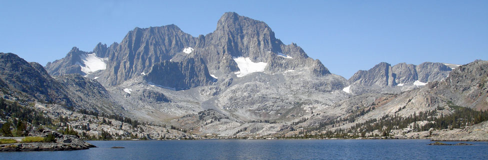
Once across Donohue Pass the trail descends through open country and into the trees, passing the Waugh Lake lateral trail before climbing to low Island Pass. Beyond the pass the trail sweeps down to spectacular Thousand Island Lake (shown above). Plan your itinerary so you spend a night there. Check camping restrictions around the mouth of the lake.

Not far beyond Thousand Island Lake, pass Garnet Lake before descending to Shadow Lake. There is no camping at Shadow Lake and some areas upstream from the lake. A stiff climb leads up to little Rosalie Lake with good camping. Then it's downhill to Reds Meadow where you will find a store, showers, supplies, and a busy campground. A summer shuttle bus ($8) connects with Mammoth Lakes.

Shop Amazon for: Hiking Poles

Side-Trips Along the Way


Marie Lakes

Two excellent side ventures are available soon after descending from Donohue Pass. Marie Lakes are about 2 miles and a thousand feet uphill from the JMT crossing at Rush Creek. Beautiful cascades along Rush Creek highlight the climb. A faint trail leads up the south side of Rush Creek to some small ponds and then veers away, climbing onto the spine of the ridge. Snow can linger on the trail, sometimes as late as early August, making route finding a little challenging. Limited, small campsites can be found near the lake's outlet.

Davis Lake

A second excellent side trip is just down the JMT where a gentle trail leads to the lower of two Davis Lakes. This pretty lake is worth an overnight stay, but campsites with views are limited. Fishing is very good for brook trout. The upper lake is nearby with a 500-foot jump in elevation. Camping is available there, and likely you will find fewer people.

John Muir Trail Map from Tuolumne Meadows to Reds Meadow, California
John Muir Trail Map of Reds Meadow area, CA


    TOP