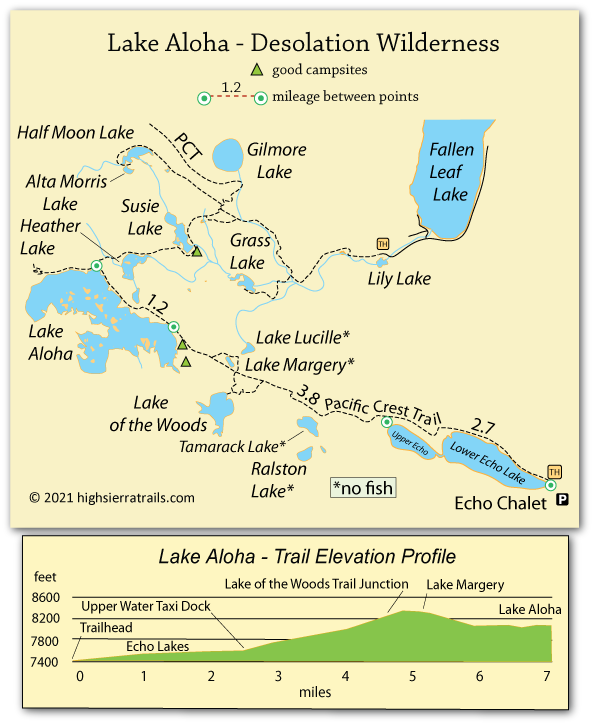
Lake Aloha Trail and Map

Desolation Wilderness

Lake Aloha, Desolation Wilderness, California

Lake Aloha Trail and Map

Desolation Wilderness


Lake Aloha Trail

The trail to Lake Aloha is 6.7 miles and only climbs about 1,000 feet, making it a manageable weekend hike. The Echo Chalet's water taxi can knock almost 3 miles off the hike, but the mostly level jaunt along the lakes is easy and offers interesting views. If you want to experience the water taxi, consider using it for your return trip. However, keep in mind that at $22 per person you will need at least 4 people to reach the minimum fee of $88. Often you can get together with other hikers if you are solo or only two.

Shop Amazon for: Hiking Poles


Echo Lake Trailhead to Upper Echo Lake Boat Taxi,

2.7 miles

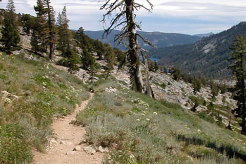
The hike along the shores of Echo Lakes passes quickly. The trail is virtually level, gaining only 100 feet. Along the way are views of the lakes and the cabins perched along the shores. Ahead, standing like twin sentinels guarding the entrance to the wilderness are Ralston and Echo peaks.

Campsites:

There is no camping along this section of the trail.
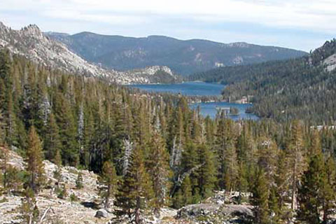
Echo Lakes, Lake Tahoe, CA

Echo Lakes


Upper Echo to Lake Aloha,

4 miles

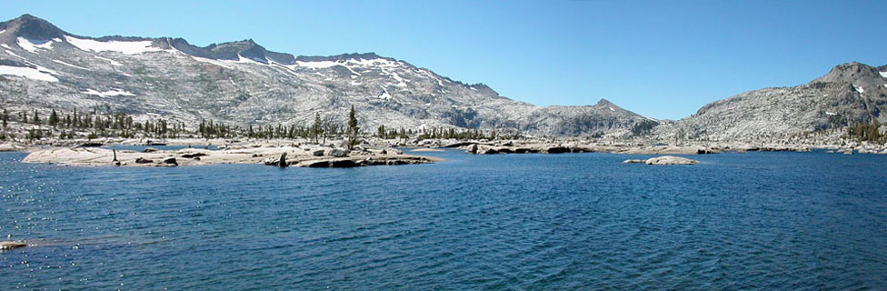
The trail climbs to a low rise near Lake Marjory before beginning a gradual descent to Lake Aloha. Various side-trails lead off the main path and down to the lake. Taking the trail just beyond Lake Marjory and following it to the lake's edge will give you a chance to assess the various camping choices along Lake Aloha's shore.


Lake Aloha trail, Desolation Wilderness, California

Trail to Lake Aloha

Alternate Trails


Fallen Leaf Lake

A trail from Glen Alpine Road near the head of Fallen Leaf Lake leads up past Susie and Heather lakes to Lake Aloha. Although the 6-mile trail is slightly shorter than the Echo Lakes route, the Fallen Leaf Lake route climbs over 2,000 feet. The climb is not a very appealing prospect for reaching Lake Aloha, but it could be an alternate way back out of the Desolation Wilderness. It, of course, would require leaving a car there at Glen Alpine Road trailhead.

Horsetail Falls

Another alternate trail to Lake Aloha - with even a more challenging climb - is from a trailhead near Twin Bridge on Highway 50. The 6-mile trail climbs relentlessly over 3,000 feet up the mountainside between Horsetail Falls and Ralston Peak, eventually connecting with the trail coming in from Echo Lakes. Once again, it might be a good alternate for returning from Lake Aloha, but not very appealing for coming into the wilderness.


Horsetail_falls, Twin Bridges, El Dorado County, CA


Alternate Trails


Fallen Leaf Lake

A trail from Glen Alpine Road near the head of Fallen Leaf Lake leads up past Susie and Heather lakes to Lake Aloha. Although the 6-mile trail is slightly shorter than the Echo Lakes route, the Fallen Leaf Lake route climbs over 2,000 feet. The climb is not a very appealing prospect for reaching Lake Aloha, but it could be an alternate way back out of the Desolation Wilderness. It, of course, would require leaving a car there at Glen Alpine Road trailhead.

Horsetail Falls

Another alternate trail to Lake Aloha - with even a more challenging climb - is from a trailhead near Twin Bridge on Highway 50. The 6-mile trail climbs relentlessly over 3,000 feet up the mountainside between Horsetail Falls and Ralston Peak, eventually connecting with the trail coming in from Echo Lakes. Once again, it might be a good alternate for returning from Lake Aloha, but not very appealing for coming into the wilderness.

Horsetail_falls, Twin Bridges, El Dorado County, CA


map of trail to Lake Akoha, Desolation Wilderness, California

  TOP