North Lake to South Lake Trail and Map, II

Kings Canyon National Park

McClure Meadow, Evolution Valley, Kings Canyon National Park, California

North Lake to South Lake Trail and Map, II

Kings Canyon National Park


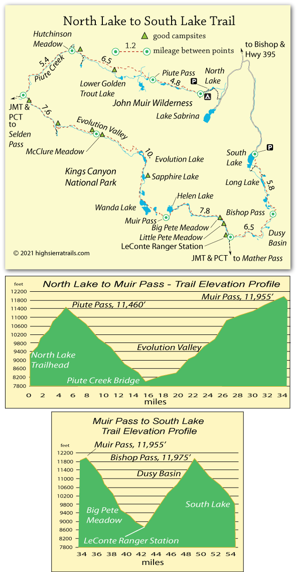
Hiking from North Lake to South Lake,
Part II

Evolution Valley to LeConte Ranger Station,

17.8 miles

At the head of Evolution Valley the trail climbs steadily until it approaches Evolution Lake. Camping is available there, but no campfires are permitted. Trees are sparse. Beyond the lake the trail climbs above tree-line and passes Sapphire and Wanda lakes before ascending to the top of Muir Pass. The stone Muir Hut sits atop the pass and serves as an emergency shelter.
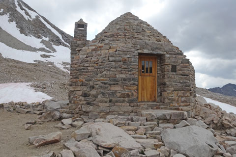
Muir Hut, Kings Canyon National Park, California

Muir Hut


Beyond the pass the trail descends to Helen Lake, a possible camping spot without much shelter. Below the lake the trail becomes challenging with boulders and tricky creek crossings as it enters LeConte Canyon. The next good camping spot is 2½ miles beyond Helen Lake. Another 2½ miles of trail smooths out at Big Pete Meadow with good camping, and the same at Little Pete Meadow a short distance farther. Less than a mile beyond Little Pete is the LeConte Ranger Station. Camping is available there, too.
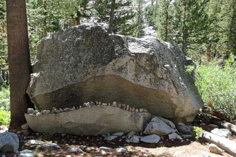
Monster Rock near Big Pete Meadow, Kings Canyon National Park, California

Monster Rock
(Watch for it on the right as you approach Big Pete Meadow.)


Shop Amazon for:
Backpacking Tents


LeConte Ranger Station to Bishop Pass,

6.5 miles

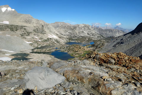
Departing from the LeConte Ranger Station the trail begins the 5-mile, 2,600-foot climb up into Dusy Basin. A possible campsite is found a mile up the trail, but most of the way is switchbacks with no good places to stop until mile 3. There, a string of shallow lakes have flat gravel areas where tents could be erected. There are virtually no trees.

Climbing higher up the trail, hikers find a couple of possible sites for tents. If storms are threatening, it is wiser to camp further back down the trail. Thunderstorms in exposed Dusy Basin can be ferocious.
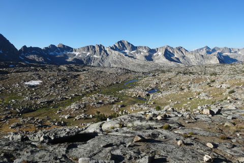
Dusy Basin, Kings Canyon National Park, California

Dusy Basin


From upper Dusy Basin to the top of Bishop Pass is another 1½ miles and 700 feet of climbing.

Bishop Pass to South Lake,

5.8 miles

Once across Bishop Pass the trail soon begins a series of steep, rocky switchbacks. Spread out below are a number of pretty lakes including Saddlerock Lake and Long Lake. As the trail approaches the lakes it becomes less rugged and settles into a gentle descent to South Lake.

View north off Bishop Pass, John Muir Wilderness, California

View North from Bishop Pass


Along the Way


Muir Hut

The stone hut on the summit of 11,955-foot Muir Pass as erected in 1930 by the Sierra Club. The structure was based on a design by Henry Gutterson. The 16-foot by 16-foot octagon hut was originally known as the John Muir Memorial Shelter. The interior is a single room with a corbelled stone ceiling, stone benches, and a fireplace. The hut was added to the National Register of Historic Places in 2016.

Commemorative John Muir Cabin

A log cabin erected to commemorate John Muir is located along the John Muir Trail, north of the Piute Creek bridge.

Monster Rock

Monster Rock is a popular stopping spot along the trail. Photographs with someone looking terrified posed inside the jaws are common.


map of trail from North Lake to South Lake, John Muir Wilderness and Kings Canyon National Park, CA