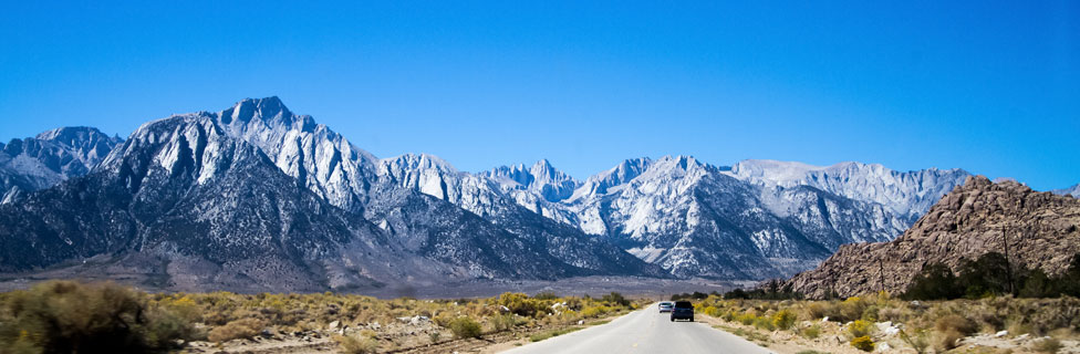
Whitney Portal
While the summit of Mount Whitney is the official southern terminus of the John Muir Trail - 210 miles from Happy Isles in Yosemite Valley - hikers still need to descend to Whitney Portal, another 11 miles. Expect to pass many hikers coming up the trail from Whitney Portal. The portal serves as the trailhead for day-hikers attempting to make the 22-mile round-trip hike to the summit of Mt. Whitney and back again to the Portal. It also is the jumping off location for hikers wanted to traverse the John Muir Trail from south to north. Because of the sharp increase in elevation from Whitney Portal to the top of Mount Whitney, most hikers prefer the north to south option which allows their bodies to acclimate to the elevation gains more gradually.
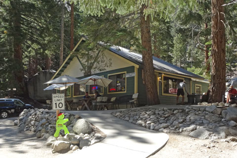
Whitney Portal Store
One of the main features at the portal is the Whitney Portal Store, located virtually at the foot of the trail. The store sells a wide variety of Mount Whitney related memorabilia ranging from decals to patches. They also offer books, maps, hiking needs (including trekking poles), clothing, and bear canister rentals. Their restaurant serves breakfast, lunch, and dinner. Showers are nearby.
The Whitney Portal Hostel and Hotel, 12 miles east in Lone Pine, has rooms available with private baths and WiFi.
Whitney Portal Area Campgrounds
Mt. Whitney Trailhead Campground is located at Whitney Portal. The campground limits campers to one-night stays prior to their departure into or return from the wilderness. The 25 campsites are first-come, first-served.
Whitney Portal Campground is ½-mile from the trailhead. Reservations can be made for any of the 43 campsites.
Lone Pine Campground is 5 miles down the road from Whitney Portal. Reservations can be made for any of its 43 campsites.
For complete information about campgrounds in the area and links to make reservations, see California's Best Camping: Southern Inyo County.
Public Transportation
Most public transportation connections can be made in Lone Pine along Highway 395, 12 miles east of Whitney Portal. Backpackers usually find it easy to hitchhike from the portal to Lone Pine.
Eastern Sierra Transit Authority
The Eastern Sierra Transit Authority (ESTA) buses run from Lancaster in the south to Reno in the north with stops at Lone Pine, Bishop, Mammoth Lakes, and other intermediate destinations. Modifications for COVID have limited their service, so it is wise to check their website for the most current information: Eastern Sierra Transit.
Yosemite Area Regional Transit
Yosemite Area Regional Transit System (YARTS) buses connect Sonora, Merced, Fresno, and Mammoth Lakes to Yosemite Valley, with stops at Lee Vining, Tuolumne Meadows, and other intermediate destinations. Modifications during COVID include reduced capacity, so reservations are strongly recommended.
Other Transportation to Yosemite Valley
Amtrak combines bus service with its trains to connect to Yosemite Valley. The most common connection is a train to Merced and then by YARTS bus to Yosemite Valley. Amtrak: San Joaquins
Greyhound Bus service is similar to Amtrak, using YARTS to make the leg from Merced to Yosemite Valley. Greyhound
Yosemite National Park's website has a helpful page showing how to get to Yosemite Valley using public transportation from major cities in California such as San Francisco, San Jose, and Fresno. Visit Yosemite Using Public Transportation
Once in Yosemite Valley, free shuttle buses connect to all the key stopping points in the valley. Other paid buses from the valley take visitors to Tuolumne Meadows or Glacier Point.