Sixty Lake Basin Trail and Map

Kings Canyon National Park

Sixty Lake Basin, Kings Canyon National Park, California

Sixty Lake Basin Trail and Map

Kings Canyon National Park


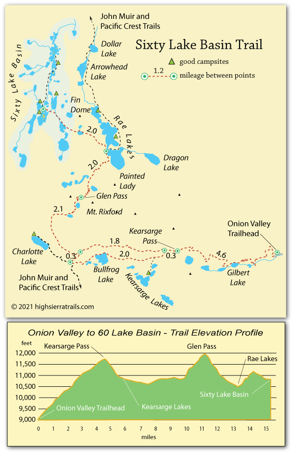
Hiking to Sixty Lake Basin

The trail from Onion Valley in the Eastern Sierra over Kearsarge and Glen passes to Sixty Lake Basin is a challenging route, but the spectacular scenery along way makes the trip go easier. Lakes, grand valleys, soaring granite peaks, and panoramic vistas are encountered at nearly every turn of the trail.

Shop Amazon for: Hiking Poles


Onion Valley to Kearsarge Lakes,

5.7 miles

The trail from the Onion Valley parking lot begins climbing immediately, soon passing a series of scenic mountain lakes, including Gilbert Lake and Flower Lake. Hikers emerge above timberline for the last mile to the top of Kearsarge Pass (4.6 miles).
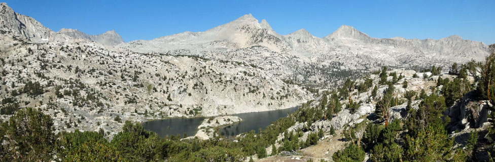
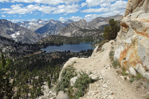
Kearsarge Lakes, Kings Canyon National Park, California

Kearsarge Lakes


Kearsarge Lakes offer a convenient overnight camping destination before tackling Glen Pass. Bear boxes are no longer available at Kearsarge Lakes (2017). Although there is no camping at Bullfrog Lake, an alternate camping stop at Charlotte Lake is 3.5 miles from the summit of Kearsarge Pass.


Bullfrog Lake, Kings Canyon National Park, California

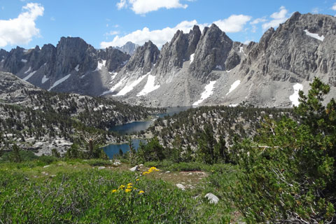
Bulfrog Lake from Kearsarge Pass Trail


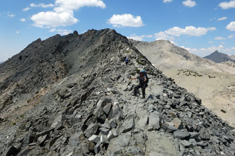
Kearsarge Lakes to Glen Pass,

5.5 miles

Follow the trail 2 miles past Bullfrog Lake to the John Muir Trail, pausing to refill water bottles along the way. The most strenuous section of the climb up Glen Pass comes about 1.3 miles from the summit. At the top, spectacular views spread before you. (For those camped at Charlotte Lake it is a 3.5-mile hike to the top of the pass.)

Glen Pass to Sixty Lake Basin,
4 miles

From Glen Pass the trail descends 2 miles to the Sixty Lake Basin side-trail, marked by a sign. Camping at beautiful Rae Lakes is well-worth considering before continuing over the 700-foot ridge into Sixty Lake Basin.

Glen Pass, Kings Canyon National Park, California

Summit of Glen Pass

A Slower Paced Itinerary to Sixty Lake Basin

Crossing 2 high Sierra passes in 2 days can be a little challenging. Slowing your pace allows your body to adjust to the altitude while at the same time enjoying some of the scenic places along the trail.

One option is to arrive at the Onion Valley trailhead mid-day and only hike a few miles up the trail before setting up camp at one of the wonderful lakes on the east side of Kearsarge Pass. Flower Lake seems to attract a number of campers every night, but by heading south cross-country a short hike reaches the shore of Matlock Lake or one of its neighbors for a relaxing overnight stop.

Another good camping spot on the south side of Glen Pass is Charlotte Lake, 3.5 - 4 miles from the top of Kearsarge Pass. The best campsites are toward the northwest end of the lake where there are bear boxes available. A ranger station is located part way down the shoreline. Fishing is fairly good.

Alternate Trails to Sixty Lake Basin

Every season many hikers enjoy the classic Ray Lakes Loop, a 41.4-mile circuit beginning and ending at Road's End in Cedar Grove. One route is to hike up through Paradise Valley and up Woods Creek to Rae Lakes, a 23-mile journey. The other route leads up Bubbs Creek, through Vidette Meadow and over Glen Pass to Rae Lakes. Either way, a short 2-mile hop from Rae Lakes leads to Sixty Lakes Basin.

A Slower Paced Itinerary to Sixty Lake Basin

Crossing 2 high Sierra passes in 2 days can be a little challenging. Slowing your pace allows your body to adjust to the altitude while at the same time enjoying some of the scenic places along the trail.

One option is to arrive at the Onion Valley trailhead mid-day and only hike a few miles up the trail before setting up camp at one of the wonderful lakes on the east side of Kearsarge Pass. Flower Lake seems to attract a number of campers every night, but by heading south cross-country a short hike reaches the shore of Matlock Lake or one of its neighbors for a relaxing overnight stop.

Another good camping spot on the south side of Glen Pass is Charlotte Lake, 3.5 - 4 miles from the top of Kearsarge Pass. The best campsites are toward the northwest end of the lake where there are bear boxes available. A ranger station is located part way down the shoreline. Fishing is fairly good.


Sixty Lake Basin trail map, Kings Canyon national park, CA

TOP