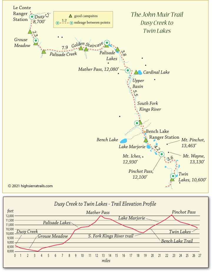
John Muir Trail Map 6
Dusy Creek to Pinchot Pass
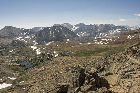
Two miles down the trail from the LeConte Ranger Station, Grouse Meadow is a beautiful spot to camp. A mile beyond, a lateral trail heads down the Middle Fork of the Kings River, while JMT hikers begin a 10-mile climb to Mather Pass. The steps on the Golden Staircase are challenging, and the trail descending the south side of Mather Pass is steep and narrow. On the way up the pass watch for views of the jagged Palisades (shown above) in the distance.
Follow the South Fork of the Kings River to a wide and sometimes dangerous ford. Soon after the crossing, pass the turnoff to Bench Lake, a worthy side trip and camping spot 1½ miles to the west. Continue uphill past glistening Lake Marjorie before the final ascent to Pinchot Pass.
Pinchot Pass to Twin Lakes
An easy descent from Pinchot Pass brings hikers to the shores of Twin Lakes. The lakes are a favored campsite for northbound hikers wanting to get a early start for Pinchot Pass, but most southbound hikers continue 4 miles downhill to find more shelter at the Woods Creek crossing, a popular camping area for JMT hikers.