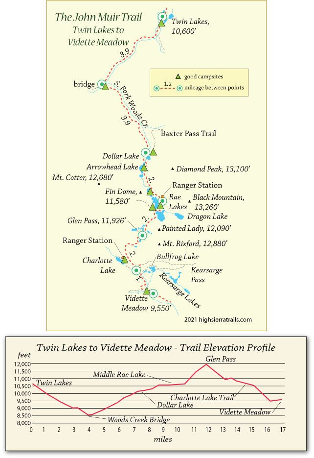
John Muir Trail Map 7
Twin Lakes to Rae Lakes
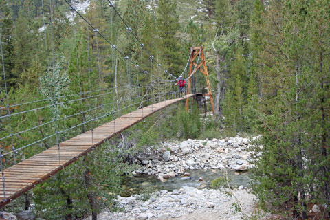
An easy descent along the north fork of Woods Creek leads to a bridge at Woods Creek Crossing. On the south side of the bridge spreads a popular camping area for JMT hikers. It makes a good place to rest up and visit with fellow JMT backpackers. The trek up the South Fork of Woods Creek is a long, steady climb with few good camping spots along the way. Views back down the canyon toward Window and Crater peaks are magnificent.
Pause to catch a photograph of the reflection of Fin Dome in Dollar Lake's crystal water. Then continue up the trail past Arrowhead Lake and the lowest of the Rae Lakes. Plan to camp at one of the lakes. A sign, a short distance beyond the ranger station, points to a large camping area with bear boxes and plenty of nice campsites tucked among the rocks and trees.
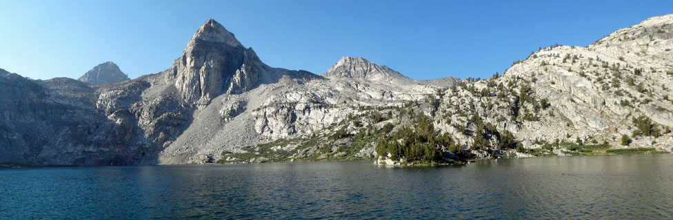
Swimming and fishing are a great break from the trail. Evening and morning light on Painted Lady and neighboring peaks make dramatic photographs.
Shop Amazon for:
Fishing Rod and Reel
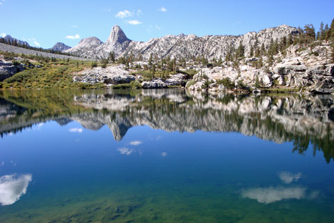
Dollar Lake and Fin Dome
Rae Lakes to Vidette Meadow
With an early morning start, the climb to the summit of Glen Pass is less of a challenge than many previous passes. Panoramic views from the pass make you glad you brought your camera. A good map will help you identify distant peaks. Descend the rugged trail to the south. After 2 miles pass several trail junctions. A trail leading east crosses Kearsarge Pass and is used by some hikers to resupply. A ½-mile trail to the west takes you to Charlotte Lake with good camping spots. No Camping is allowed at Bullfrog Lake.
Descend on the JMT to Vidette Meadow, a favorite camping area for hikers. Be wary of bears, but as long as you secure your food in a canister, you will likely have no problems. Fishing is good in Bubbs Creek.
Along the Way
Woods Creek Suspension Bridge
Baxter Pass
Near Dollar Lake a lateral trail cuts back across a talus slope and then up to Baxter Lakes. Fishing is good there. The trail crosses the Sierra crest at Baxter Pass, 12,283 feet. Similar to Taboose Pass, the poorly maintained route then descends 6,000 feet into the Owens Valley, connecting to Highway 395, two miles north of Independence.
Sixty Lake Basin
A trail leading off the JMT at the upper Rae Lake leads over a low ridge and into Sixty Lake Basin. Less crowded than Rae Lakes, the basin offers more unspoiled campsites and mild terrain for exploring.